


Georgia is known for its waterways, especially its rivers. Whitewater kayaking hotspots can be found on several of these rivers in the northern part of the state.
The following North Georgia rivers have sections of whitewater perfect for the beginner paddler, while some are for the more experienced kayaker. Pay attention to the rapid classes in the descriptions to see what river is best for your experience level.
Cartecay River
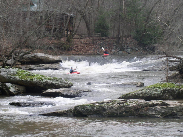
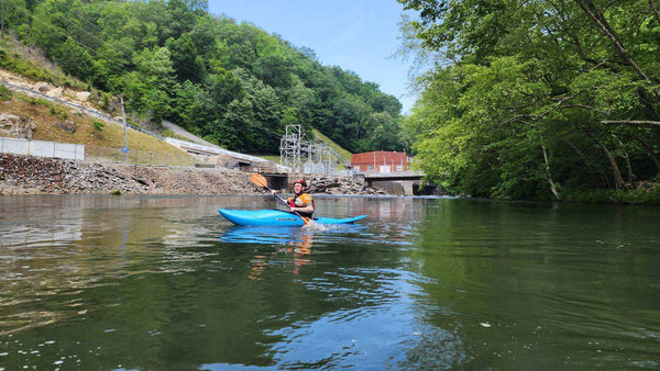
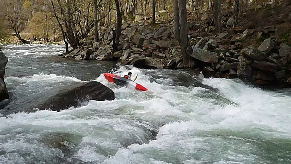
North Georgia's Cartecay River near Ellijay, GA is a popular recreational area where both locals and visitors enjoy many outdoor activities. The Cartecay River basin covers 86,734 acres, which are largely undeveloped. While the start of the river run is calm, it is also the site of several Class II/Class III whitewater rapids, perfect for beginner whitewater kayakers.
Sections and Rapids
Lower Cartecay Road to Stegall Mill Road
Put in at the bridge on Lower Cartecay Road. This section offers a series of natural features, including chutes, small islands, shoals, and a swirling eddy as well as Class II/III rapids, culminating at Blackberry Falls for an epic finale! The Stegall Mill Road takeout is just past the bridge downriver from Blackberry Falls on the right, or continue on the second-leg to DNR.
More information about running whitewater through this section of the Cartecay can be found on the American Whitewater page.
Stegall Mill Road to DNR
This extended leg on the second-half of the Cartecay River features ledge drops, swirling pools, Class II/III rapids, and the craggy Clear Creek Falls.
More information about running whitewater through this section of the Cartecay can be found on the American Whitewater page.
Local's Tip
Clear Creek, a tributary of the Cartecay at the base of Clear Creek Falls, makes for a great beginner's creeking trip. Please note that water levels may be unpredictable here.
Upper Chattahoochee River
The Upper Chattahoochee River Water Trail is approximately 36.2 miles long and is located upstream of Lake Lanier, beginning at the confluence of Sautee Creek and the Chattahoochee in White County and ending at Clarks Bridge Park in Hall County. There are eight access points and six sections along the corridor that may be used by boaters. Wildwood Outfitters provides access to several GA DNR sites that are not yet fully open to public access, including camping at Buck Shoals State Park.
Sections and Rapids
Section III - Hwy 115 Bridge to Hwy 384 Takeout
The Upper Hooch (not to be confused with Section 3 on the Chattooga River) is a classic beginner kayaking stream. It is relatively short, has an easy shuttle, beautiful scenery, and fun rapids. It can be run at all levels from ridiculously scrapy to screaming high flood stage, depending on the boater’s skills.
At low flows, the Upper Hooch is a Class II stream. Around 3-4 feet on the Leaf Gage, it is easily a Class III section of whitewater. Above that, it's Class III-IV with some huge holes.
More information about running whitewater through the Upper Hooch can be found on the American Whitewater page.
Parking Info
The put-in and take-out is Georgia State Park land, and requires either a daily pass ($5) or an annual pass.
Our friends at Wildwood Outfitters will shuttle you and your boat to the put-in for $7. The outpost is usually closed during the winter, late October to early March. Visit their website for more info.
Chestatee River
The Chestatee River is an excellent beginner's river located within an hour of metro Atlanta. It begins at the confluence of Dicks Creek and Frogtown Creek in Lumpkin County near Dahlonega, and flows south toward Lake Lanier. It is considered a major tributary of the Chattahoochee River. The Chestatee River has 4 sections, we suggest checking out the middle two for whitewater kayakers.
Sections and Rapids
Section 2 - Town Creek Church Bridge (Garnett Bridge) to Copper Mine (Grindle Falls/Grindle Shoals Section)
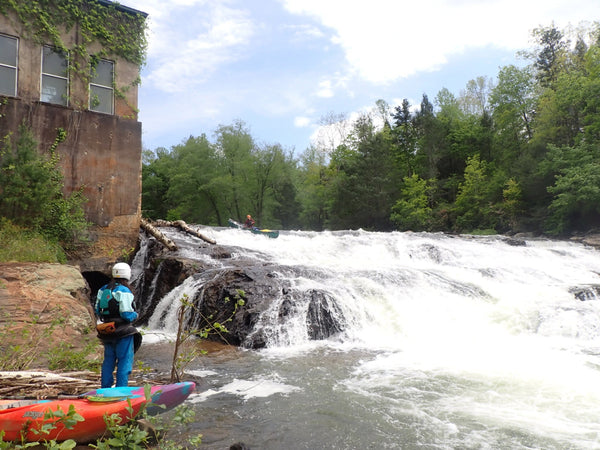
This is the most exciting section of the Chestatee. It is 3.8 miles long, including Class II-II+ rapids at the put-in and in the first 2+ miles, Class V Grindle Falls (Grindle Shoals), and Class III+ Copper Mine at the take-out. The two miles from shortly below Grindle Falls to shortly above Copper Mine are flatwater.
Grindle Falls (Grindle Shoals) is a fun series of vertical drops and slides. The falls can be run by going either right or left of the island above them (see comments below): scouting is necessary to make sure the chosen route isn't blocked by trees. In the past there have been access problems with the landowner on the river right bank. It is best to be quick and discreet when scouting from either bank or portaging. Portaging Grindle Falls is difficult: neither bank is easy, but the left is less difficult. The property on both sides is private, so do not linger. There is no good portage option other than the banks.
Put In and Parking
The put-in at Town Creek Church Bridge (Garnett Bridge) includes a parking area sufficient for several cars. The easiest way down the steep hill to the river is via the path on the upstream side of the bridge, right at the parking area.
More information about running whitewater through Section 2 of the Chestatee River can be found on the American Whitewater page.
Section 3 - Copper Mine to Lumpkin County Park
The Coppermine to Lake Lanier stretch of Chestatee River is 32 miles long and has been determined by American Whitewater to be a Class I-II(III) section. From Copper Mine to Highway 52, the gradient drops to 13 fpm. The scenery is good, but the number of riverside residences is increasing. The section contains several Class II rapids (including Three Islands, The Rock Gates, Big Sky and Oh, THAT Rock) including Blasted Rock Rapid, named for the sharp, dynamite-blasted rocks that form it.
There are put-ins on Highways 60 and 52. Most boaters choose to take out at Highway 400.
More information about running whitewater through Section 3 of the Chestatee River can be found on the American Whitewater page.
Chattooga River
The Chattooga River, flowing from the Carolinas into North Georgia, is a world-class whitewater river. It is also one of the longest free-flowing rivers in the Southeastern United States. It offers some of the best boating in the region, making it an exciting outdoor experience.
Sections and Rapids
Section III
There are two very distinct whitewater rafting sections on the Chattooga; Section III is known as “Mild & Scenic”, with numerous swimming holes, Class II-III rapids, and a Class IV grand finale at the famous Bull Sluice rapid. Section III begins at Earl’s Ford on the South Carolina side of the Chattooga, and takes out at the Highway 76 Bridge Access.
Section IV
Just downstream on Section IV, the Chattooga picks up the pace. Section IV of the Chattooga is located near Clayton, GA. It is defined by starting at Route 76 Bridge and ending at the Tugaloo Lake Boat Ramp. This is one of the most well-known sections of whitewater in the US. Section IV includes major whitewater, including Five Falls, a set of five Class IV-V rapids within 1/3 of a mile.
Section IV is a serious whitewater section for advanced boaters. More information about running whitewater through this section can be found on the American Whitewater page.
Put Ins and Parking
There are parking areas on both the Georgia and South Carolina side of the river.
On the Georgia side you will find a small hikers' parking area ($2.00 fee), which holds about 5 cars. You can put in here with a short walk down to the river. The walk is a little shorter than the paved road to the beach below Bull Sluice or the trail to that rapids. However, if you put in here you miss Bull Sluice rapid.
There is a large USFS parking lot on the SC side of the river with changing rooms and bathrooms and with no parking fee. Follow the paved path about 250 yards to the beach below Bull Sluice or take the trail off to the right and put in right above Bull Sluice. Boaters sometimes access this river via Stekoa Creek.
To get to the take-out
From the put-in, head left out of the parking lot (east) for about 2.5 miles or so and turn right on Orchard Road. Follow Orchard Road until it dead-ends on Battle Creek Road (across from the Dixie Aluminum plant). Turn right on Battle Creek. Stay on Battle Creek; you will come to a sharp right turn in the road--stay on the paved road. You are now on Damascus Church Road. Just past the little white church on the left, bear right onto Bull Sluice Road. This is a dirt road and you will see a sign for the Tugaloo Boat Ramp. Follow this dirt road all the way to the end and park at the boat ramp. Round trip is about 45 minutes.
Honorable Mentions
Two out of state destinations for North Georgia kayakers are the Ocoee River in Tennessee and the Nantahala River in North Carolina.
Ocoee River
The Ocoee River is a popular whitewater destination for North Georgia kayakers. A short drive from North Georgia to Tennessee, the Ocoee is Southeast Tennessee’s iconic whitewater river. The river is dam controlled at 3 levels creating 3 sections – the upper, middle and lower, each offering very different paddling options. The Upper and Middle sections are two popular whitewater sections.
Upper Ocoee
The Upper Ocoee River provides 5 miles of challenging whitewater in a spectacular mountain setting. Considered by many to be the birthplace of freestyle kayaking, the Ocoee was world famous before it hosted the 1996 Olympics’ whitewater events. The Upper Ocoee includes the Class IV Olympic course, and should only be attempted by the most experienced paddlers.
Middle Ocoee
The Middle Ocoee is the most popular section of the river and run of choice for thousands of kayakers each year. This section boasts 5 miles of nearly continuous Class III-IV whitewater including several surf-worthy hydraulics and kayak play spots like Washing Machine, Double Suck, Flipper and Hell’s Hole.
Nantahala River
The Nantahala River is the classic southeastern river for entry level whitewater. As a Class II-III river, The Nantahala is considered ideal for both the first-timer and experienced kayakers. The river has a wealth of rapids running the length of the 8.1 mile whitewater section, with over 20 named rapids.
The fun begins with Class III Patton's Run followed immediately by Class II+ Tumble Dry. Downstream of Ferebee Park is the well-known Delabar's Rock, featuring two Volkswagen sized rocks on river left, one after the other.
Whirlpool Rapid is marked by a large slanted rock on river left, behind which is the infamous whirlpool -- a powerful eddy known to many boaters. Kayakers can be seen surfing the wave that furls off the rock or getting enders if their playboats are small enough.
A fitting climax to the run, Nantahala Falls is just above the usual take-out. At the base of the Falls is the area where kayakers and canoeists may spend much of their time perfecting play moves or practicing ferrying techniques.
Conclusion
We hope this overview of whitewater hotspots in North Georgia and adjacent states was helpful to you. Whether you’re a beginning whitewater kayaker, or an experienced paddler, there is a lot of fun to be had in North Georgia. If you have any questions, need advice, additional information, or new gear, please stop by the Festive Water shop, or contact us! We’d be glad to help in any way we can.


