


As the thermostat starts to rise this summer, finding some water to cool off is an absolute must in Georgia. A kayaking or paddleboard trip on the scenic lakes and rivers of North Georgia is the perfect summer time escape from the heat.
North Georgia’s waterways offer spectacular scenery ranging from mountains and forests, to historic sites and landmarks, to beautiful lakeside mansions and abodes. Aside from the views, you can also see the native wildlife, from the birds like kingfishers, herons, and osprey, to the fish and turtles swimming beneath you, and deer, otters, beavers, and other animals along the shore line.
Fortunately, no matter if you’re in the mountains of North Georgia, closer to metro Atlanta, there’s always an awesome river or lake nearby for you to enjoy in your kayak. Read on to learn more about 7 great spots to kayak in North Georgia.
Sweetwater Creek State Park in Lithia Springs, GA

One of the closest spots for kayaking or paddleboarding near Atlanta is Sweetwater Creek State Park. Just a few minutes from downtown, you’ll follow a beautiful wooded trail to the water. The experience is capped off by the historic ruins of a 1800’s textile mill. Given its proximity to downtown, this area can get crowded - so get there early.
For paddlers near Atlanta, this is one of the most accessible trails in the area. A quick hike through woods leads you to a historic textile mill and takes you to the waters outside of downtown Atlanta. Out on the water, there are tons of fish and plenty of space on the over 200 acres of the George Sparks Reservoir.
To protect the historic mill ruins and maintain safety, access to the interior is closed to all visitors except those on guided hikes (public and private), school field trips and for special events. Hikes to the exterior of the mill ruins are still available on your own and encouraged.
For up-to-date information about kayaking and other amenities at Sweetwater Creek State Park, check out the Georgia State Parks website.
Lake Tugalo near Tallulah Falls, GA
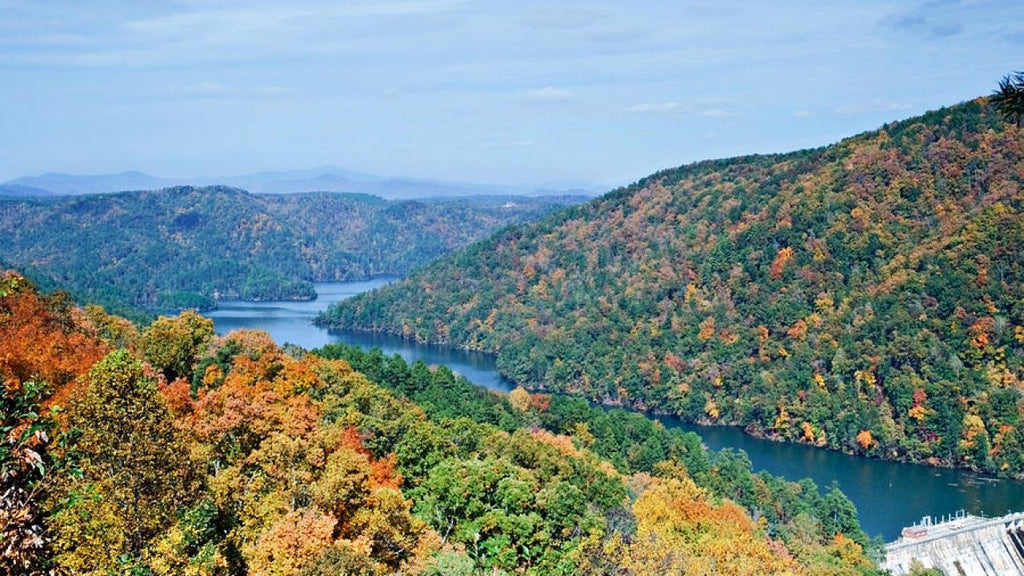
Lake Tugalo, near Tallulah Falls, is a 597-acre reservoir with 18 miles of shoreline. Owned and operated by the Georgia Power Company, Lake Tugalo is created by the Tallulah and Chattooga Rivers. With no development, it remains one of the most serene lakes in the state.
With over 5 miles of water, Lake Tugalo is a more narrow lake with less wind. Many folks combine fishing with a paddle and have a good chance of catching bluegills and bass. And here’s a bonus: the border or Georgia and South Carolina runs down the middle of the lake, making this a great addition, not just for kayaking in northern Georgia, but also to a South Carolina paddling trip.
Little River in Woodstock, GA
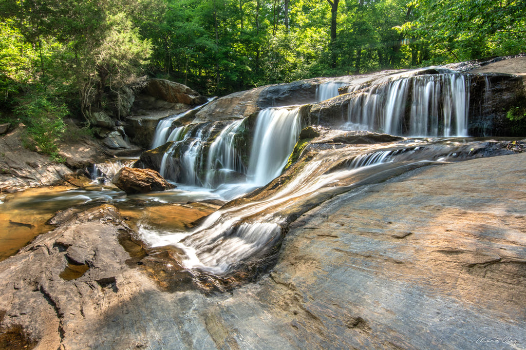
Olde Rope Mill Park in Woodstock, GA is one of our favorite places to refer to newer kayaks for an enjoyable afternoon on the water. This Woodstock park has everything you could want for fun - including a historic site, 20 miles of hiking and mountain biking trails, fishing and kayaking on the Little River, which flows into one of the most beautiful lakes in Georgia.
The Little River lazily flows down from Old Rope Mill Park, winding its way to Lake Allatoona. Once past the I-575 bridge, the woods and wildlife start taking over, and lead you to Toonigh Creek Falls, where you can get out of your kayak or paddle board and enjoy the falls and water.
Hollis Q. Lathem Reservoir near Ball Ground, GA
Right down the road from the famous Gibb’s Garden is one of North Georgia newest reservoirs, Hollis Q. Lathem Reservoir. Opened in 2002, the 334-acre lake is known for its pristine water since it is an important part of the Cherokee County water-supply. Because of this, there is no swimming, but you can enjoy a relaxing paddle on the lake.
Be careful exploring Lathem though, one of the notable features of the lake is the abundance of standing timber just beneath the water’s surface. A hidden gem of the lake is the Yellow Creek waterfall at the north end, only accessible by kayak or paddleboard, since it’s protected by an extremely shallow sandbar.
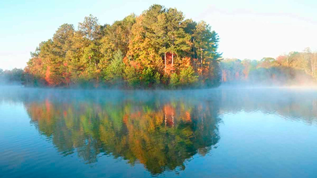
Yellow River near Lawrenceville, GA

An intimate river with a piedmont flavor, the Yellow River Water Trail stretches from suburban Atlanta to Lake Jackson covering the counties of Gwinnett, Dekalb, Rockdale and Newton with put-in and take-out points located approximately every 5-10 miles. The 53 mile river is mostly flatwater, and has a wide array of wildlife and a rich history from prior mill towns and Native American Indian settlements. The upper suburban stretches offer locals a quiet, peaceful, paddling getaway from hectic life.
Section One of the Yellow River
Five Forks Rd Bridge Access to Highway 78 Access
The easiest access to the Yellow river is also the northernmost, the Five Forks Road Access between Snellville and Lawrenceville. The Five Forks Bridge Access represents the upper point for year round navigable water depth. This suburban section winds between wooded neighborhoods. From spring through fall, paddlers will rarely see a house due to the thick canopy of trees. This is a beautiful section of flowing flatwater with the occasional small shoal. You may encounter a tree across the river that will need to be negotiated, although storm flows normally keep the river clear.
As you pass the Killian Hill Bridge the river will slowly widen and, with occasional low water levels, become shallow. When you near the Yellow River Game Ranch, you will hear some of their animals and perhaps see some of their guests. The take-out is under the Hwy 78 bridge. You can combine your Yellow River paddle with a family visit to the Yellow River Game Ranch, and also enjoy a beverage and snack at Alcovy Coffee House, located on the scenic shore of Lake Lucerne, on Hwy 78 across from the take-out.
Learn more about the Yellow River Water Trail on the GA River Network website.
Moccasin Creek State Park and Lake Burton near Clarksville, GA

Sitting on the shores of lovely Lake Burton, Moccasin Creek prides itself on being “where spring spends the summer.”
At 2,800 acres, Lake Burton in Moccasin Creek State Park is the largest lake in the five lakes that make up the Tallulah River basin. The lake is a water sports enthusiast's dream, perfect for paddling a canoe, kayak, or paddleboard. We recommend bringing a fishing rod too. Those looking for their next fresh catch will have the opportunity of putting trout on the table as the Lake Burton Fish Hatchery raises fish to stock in the streams that surround the area.
A recommended side trip would include the two cascades that make up the Hemlock Falls. The park's central location makes it a perfect jumping off spot for exploring area waterfalls, mountain bike trails, shops and restaurants.
Learn more about Moccasin Creek Start Park and Lake Burton on the Georgia State Parks website.
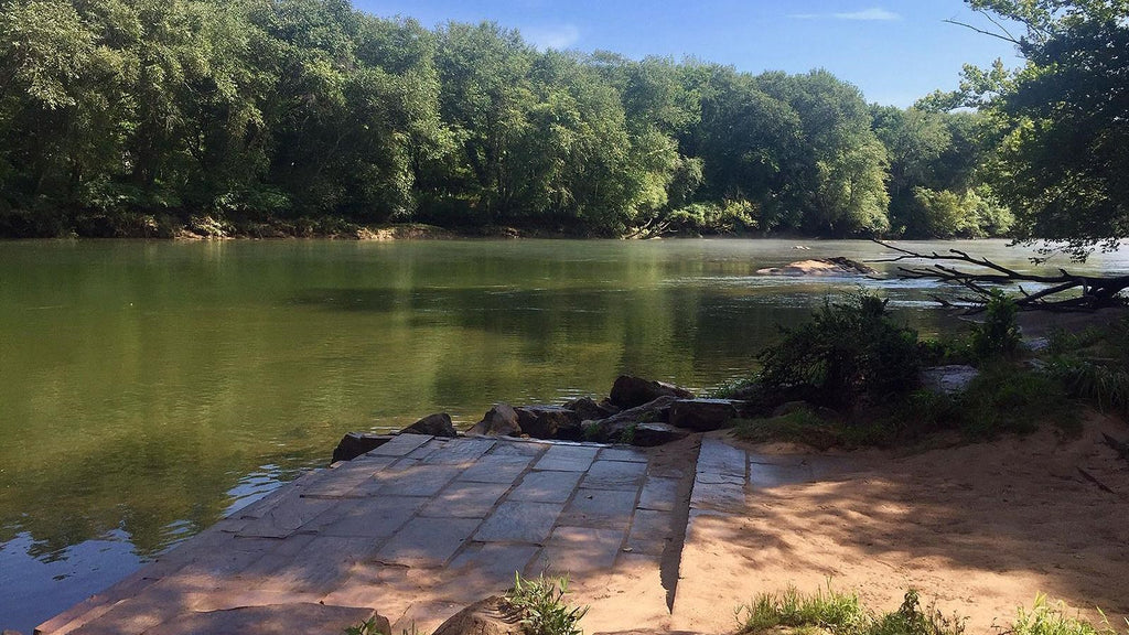
Chattahoochee River National Recreation Area
This list would not be complete without mentioning the Chattahoochee River. The Chattahoochee River National Recreation Area is home to 48 miles of waterways popular for water sports such as kayaking, rafting, and fishing. The surrounding nature is great for combining a paddle with a picnic on the rocky shores. Since the Chattahoochee actually runs through much of North Georgia, you can find any number of places to put in for either kayaking or just floating the river.
Buford Dam to Settles Bridge
Safety
US Coast Guard approved life jackets must be worn by all people, regardless of age, from below the Buford Dam to the Hwy 20 Bridge. Before setting off on your journey, call (770) 945-1466 for a recorded message about when water from the dam will be released. Plan your trip for after or well before the release time. If you hear horns blowing, get off the river. This is the signal that water is about to be released from the dam.
If you are looking for adventure along the 48 miles of the Chattahoochee River National Recreation Area, the Bowmans Island to Settles Bridge trip is second best trip for families with young children, as the “rapids” will thrill the youngsters while presenting little danger of having a boat overturn. If your children can swim and are just taking up kayaking, you can’t go wrong with this trip. While most of the rapids are not much more than large ripples, there is one not far from the start that might put some water in your boat.
Not far from the start of your journey you will come to the actual “Bowmans Island” and the river forks around it, coming back together at the end of the island. At a little over four miles in length, this is a great trip for children—long enough to have fun, but short enough so that they don’t start asking, “Are we there yet?” every five minutes. If a picnic is in the plans, for the first two miles there are no places to pull over, but beyond the two mile point you will find a few small “beaches, ” including one near the 346 mile marker -about an hour from the starting point.
Water Quality
Be sure to check the Current Estimated E. coli count before starting your trip. If the count at Medlock Bridge is greater than 235 you have an increased risk of getting sick. Contact with the river is NOT recommended.
Water Release Schedule
Water conditions on the Chattahoochee River are influenced on a daily basis by water releases from Buford Dam. The water release schedule can be obtained by calling (770) 945-1466, or toll free 1-855-DAM-FLOW (1-855-326-3569), or visit their Hydropower Generating Schedule website. Besides showing the time for scheduled releases it also shows how many turbines will be operating and the current flow in cubic feet per second (cfs). It takes approximately 45 minutes for water released from Buford Dam to begin rising at Settles Bridge.
River Flow Rates
Water conditions on the Chattahoochee River are also influenced by the weather upstream of Settles Bridge. Regardless of whether the water is coming from a dam release or inclement weather upstream check the discharge/flow rate at the gaging station below Buford Dam.
If Canoeing, Kayaking, or Stand Up Paddleboarding and the flow rate is over 4,000 cfs, cancel your trip. Float tubes are prohibited on this stretch of the river due to cold water temperatures.
Conclusion
We hope this overview of places to kayak and paddleboard around North Georgia and Atlanta was helpful to you. Whether you’re a beginner kayaker, or an experienced paddler, there is a lot of fun to be had in North Georgia. If you have any questions, need advice, additional information, or new gear, please stop by the Festive Water shop, or contact us! We’d be glad to help in any way we can.


